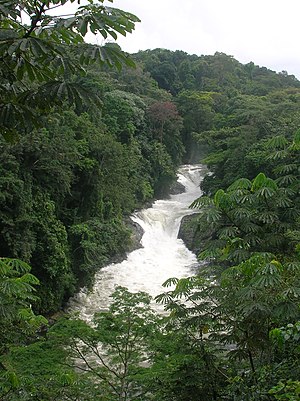
Cross River State
Cross River State chi state efu South-South geopolitical zone of Nigeria. Odu nwu kwi ẹfu Cross River, mafu state le nyi kwi ẹfu eastern part of the Eastern Region ọjọ 27 May 1967. Ugwẹtañ chi calabar, ini ọme tẹju north lẹfu Benue state, tẹju west lẹfu Ebonyi state kpamani Abia state, kpamani tẹju southwest lẹfu Akwa Ibom state, ubilé ñno dóla mayu hiọmẹ udaba éjòwò gbodaà Cameroon.[1]akwu bi amóne che moó ki South-Eastern State ubila rioduñwu da ti cross river ẹfu ọdọ 1976, Cross River state akwubi che nè anè ti fi akwa iboma, amaa aboji Akwa Ibom mu du state, ki ya mudu distinct state éfu ódo 1987.[2]
| Inception | 3 ochu ekeji 1976 |
|---|---|
| Native label | Cross River State |
| Named after | Cross River |
| Official language | English |
| Continent | Africa |
| Country | Nigeria |
| Capital | Calabar |
| Located in the administrative territorial entity | Nigeria |
| Located in time zone | UTC+01:00, Western European Time |
| Coordinate location | 5°45′0″N 8°30′0″E |
| Office held by head of government | Governor of Cross River State |
| Executive body | Executive Council of Cross River State |
| Legislative body | Cross River State House of Assembly |
| Owner of | Tinapa Resort |
| Shares border with | Akwa Ibom State, Abia, Ebonyi State, Benue |
| Replaces | South Eastern State |
| Postal code | 540001 |
| Official website | http://www.crossriverstate.gov.ng |
| Country calling code | +234 |
| Category for maps or plans | Category:Maps of Cross River State |

Efu ami 36 states ki dẹfu Nigeria, Cross River state chi ekegwele ki nèna wè né éfu
kpamankpai éne’ki ogwu yo mebíe ki wéwé alu ku ma usgbaluka wéwé ki dabi r 3.8 million adiko ọdọ 2016.[3] Geographically, state le che oj llẹ kperu agbada Guinean forest–savanna mosaic ẹfu far north kpamani the Cross–Sanaga–Bioko coastal forests ẹfu ojilẹ ẹyi interior state le. ecoregions de kéke ki chi ami Central African mangroves ki dẹfu coastal far south kpamani ki de íba ka éfu montane Cameroonian Highlands forests ki dẹfu extreme northeast.ógogaga alile yi geographical feature chi ukpodu state le, the Cross River, ki bisects the state's interior taki'nyi ojilẹ state's western border, kpamani iya'cha nyi ẹfu Cross River Estuary. Ami aji kibọ ki cha'koko chi Calabar kpamani Great Kwa rivers, kiya cha kwi the inland Oban Hills, before flanking the city of Calabar kpamani ya nwọ cha tẹfu Cross River Estuary onugo. Ẹfu ami forested interior ẹyi state le n'ami several biodiverse protected areas including the Cross River National Park, Afi Mountain Wildlife Sanctuary, kpamani Mbe Mountains Community Forest. Wildlife reserves ki deyi ni populations ẹyi Preuss's red colobus, African forest buffalo, bat hawk, tree pangolin, grey-necked rockfowl, kpamani West African ale ku ma do ónye, kpai ícha abo ki bo ojané Nigeria-Cameroon chi úkabuû, drill, Ami adagba di African forest , kpamani Cross River gorilla populations.[4][5][6][7]
References
nwọ́che- ↑ E.J. Alagoa, Tekena N. Tamuno (1989). Land and people of Nigeria: Rivers State.
- ↑ "This is how the 36 states were created". Pulse.ng. 24 October 2017. Retrieved 15 December 2021.
- ↑ "Population 2006-2016". National Bureau of Statistics. Retrieved 14 December 2021.
- ↑ "Cross River National Park (Oban Division)". WCS Nigeria. Retrieved 16 December 2021.
- ↑ "Cross River National Park (Okwangwo Division)". WCS Nigeria. Retrieved 16 December 2021.
- ↑ "Afi Mountain Wildlife Sanctuary". WCS Nigeria. Retrieved 16 December 2021.
- ↑ "Mbe Mountains". WCS Nigeria. Retrieved 16 December 2021.
